|
| |
Understanding GPS Technology
Introduction
How Does GPS Work
Triangulation
Measuring Distance
Timing
Satellite Tracking
Handling Errors
Timekeeping
For more
information
Introduction
Trying to figure out where you are is probably one of
humankind's oldest problems. Navigation and positioning are crucial to so
many activities and yet the process has always been quite cumbersome and
inexact. In the earliest days mankind used the stars to navigate. Early
instruments also sited the stars to determine position. The science of horology
began in part because navigation depended on precise timing the movement of the
stars.
Over the years all kinds of technologies have tried to simplify the task but
every one has had some disadvantage. Finally, the U.S. Department of Defense
decided that the military had to have a precise form of worldwide
positioning. Fortunately they had the deep pockets it took to build something really good. The result is the Global
Positioning System, a system that's changed navigation forever.
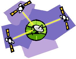
The Global Positioning System (GPS) is a worldwide radio-navigation system
formed from a constellation of 24 satellites and their ground stations.
GPS uses these "man-made stars" as reference points to calculate positions
accurate to a matter of meters. In fact, with advanced forms of GPS you can make
measurements to better than a centimeter!
In a sense it's like giving every square meter on the planet a unique address.
GPS receivers have been miniaturized to just a few integrated circuits and so
are becoming very economical. And that makes the technology accessible to
virtually everyone.
These days GPS is finding its way into cars, boats, planes, construction
equipment, movie making gear, farm machinery, even laptop computers.
Soon GPS will become almost as basic as the cell telephone. In fact, GPS
technology is being used now in cell phones to implement the emergency ('911')
location system.
How GPS Works
Here's how GPS works in six logical steps:
- The basis of GPS is "triangulation" from satellites.
- To "triangulate," a GPS receiver measures distance using the travel time
of radio signals.
- To measure travel time, GPS needs very accurate timing which it achieves
with some tricks.
- Along with distance, you need to know exactly where the satellites are in
space. High orbits and careful monitoring are the secret.
- You must correct for any delays the signal experiences as it travels
through the atmosphere.
- Finally (for us), you can now obtain the precise time from the GPS satellites.
We'll explain each of these points in subsequent sections.
Improbable as it may seem, the whole idea behind GPS is to use satellites in
space as reference points for locations here on earth.
That's right, by very, very accurately measuring our distance from three
satellites we can "triangulate" our position anywhere on earth.
Forget for a moment how our receiver measures this distance. We'll get to that
later. First consider how distance measurements from three satellites can
pinpoint you in space.
Triangulation
- Position is calculated from distance measurements (ranges) to satellites.
- Mathematically we need four satellite ranges to determine exact position.
- Three ranges are enough if we reject ridiculous answers or use other
tricks.
- Another range is required for technical reasons to be discussed later.
The Geometry:
Suppose we measure our distance from a satellite and find it to be 10,000 miles.
Knowing that we're 10,000 miles from a particular satellite narrows down all the
possible locations we could be in the whole universe to the surface of a sphere
that is centered on this satellite and has a radius of 10,000 miles
Next, say we measure our distance to a second satellite and find out that it's
11,000 miles away.
That tells us that we're not only on the first sphere but we're also on a sphere
that's 11,000 miles from the second satellite. Or in other words, we're
somewhere on the circle where these two spheres intersect.
If we then make a measurement from a third satellite and find that we're 12,000
miles from that one, that narrows our position down even further, to the two
points where the 12,000 mile sphere cuts through the circle that's the
intersection of the first two spheres.
So by ranging from three satellites we can narrow our position to just two
points in space. This arrangement of satellites is also called a
"constellation".
To decide which one is our true location we could make a fourth measurement. But
usually one of the two points is a ridiculous answer (either too far from Earth
or moving at an impossible velocity) and can be rejected without a measurement.
A fourth measurement does come in very handy for another reason however, but
we'll tell you about that later.
Next we'll see how the system measures distances to satellites.
Measuring Distance
- Distance to a satellite is determined by measuring how long a radio signal
takes to reach us from that satellite.
- To make the measurement we assume that both the satellite and our receiver
are generating the same pseudo-random codes at exactly the same time.
- By comparing how late the satellite's pseudo-random code appears compared
to our receiver's code, we determine how long it took to reach us.
- Multiply that travel time by the speed of light and you've got distance.
Discussion
We saw in the last section that a position is calculated from distance
measurements to at least three satellites.
But how can you measure the distance to something that's floating around in
space? We do it by timing how long it takes for a signal sent from the satellite
to arrive at our receiver.
The Math
In a sense, the whole thing boils down to those "velocity times travel time"
math problems we did in high school. Remember the old: "If a car goes 60 miles
per hour for two hours, how far does it travel?"
Velocity (60 mph) x Time (2 hours) = Distance (120 miles)
In the case of GPS we're measuring a radio signal so the velocity is going to be
the speed of light or roughly 186,000 miles per second.
The problem is measuring the travel time
The timing problem is tricky. First, the times are going to be awfully short.
If a satellite were right overhead the travel time would be something like 0.06
seconds. So we're going to need some really precise clocks. We'll talk about
those soon.
But assuming we have precise clocks, how do we measure travel time? To explain
it let's use a goofy analogy:
Suppose there was a way to get both the satellite and the receiver to start
playing "Stairway to Heaven" at precisely 12 noon. If sound could reach us
from space then standing at the receiver we'd
hear two versions of the 'Stairway to Heaven', one from our receiver and one
from the satellite.
These two versions would be out of sync. The version coming from the satellite
would be a little delayed because it had to travel more than 11,000 miles.
If we wanted to see just how delayed the satellite's version was, we could start
delaying the receiver's version until they fell into perfect sync.
The amount we have to shift back the receiver's version is equal to the travel
time of the satellite's version. So we just multiply that time times the speed
of light and voila! we've got our distance to the satellite.
That's basically how GPS works.
Only instead of 'Stairway to Heaven' the satellites and receivers use
something called a "Pseudo Random Code" - which is probably quicker to sing than
'Stairway to Heaven'.
Random Code
The Pseudo Random Code (PRC) is a fundamental part of GPS.
Physically it's just a very complicated digital code, or in other words, a
complicated sequence of "on" and "off" pulses.
The signal is so complicated that it almost looks like random electrical noise.
Hence the name "Pseudo-Random."
There are several good reasons for that complexity: First, the complex pattern
helps make sure that the receiver doesn't accidentally sync up to some other
signal. The patterns are so complex that it's highly unlikely that a stray
signal will have exactly the same shape.
Since each satellite has its own unique Pseudo-Random Code this complexity also
guarantees that the receiver won't accidentally pick up another satellite's
signal. So all the satellites can use the same frequency without jamming each
other. And it makes it more difficult for a hostile force to jam the system. In
fact the Pseudo Random Code gives the Department of Defense a way to control access to the system.
But there's another reason for the complexity of the Pseudo Random Code, a
reason that's crucial to making GPS economical. The codes make it possible to
use "information theory" to "amplify" the GPS signal. And that's why GPS
receivers don't need big satellite dishes to receive the GPS signals.
We glossed over one point in our silly 'Stairway to Heaven' analogy. It assumes
that we can guarantee that both the satellite and the receiver start generating
their codes at exactly the same time. But how do we make sure everybody is
perfectly synced? Stay tuned and see.
Timing -
Achieving Perfect Timing
- Accurate timing is the key to measuring distance to satellites.
- Satellites are accurate because they have atomic clocks on board.
- Receiver clocks don't have to be too accurate because an extra satellite
range measurement can remove errors
Discussion
If measuring the travel time of a radio signal is the key to GPS, then our
stop watches had better be darn good, because if their timing is off by just a
thousandth of a second, at the speed of light, that translates into almost 200
miles of error!
On the satellite side, timing is almost perfect because they have incredibly
precise atomic clocks on board.
But what about our receivers here on the ground?
Remember that both the satellite and the receiver need to be able to precisely
synchronize their pseudo-random codes to make the system work. (to review this
point click here)
If our receivers needed atomic clocks (which cost upwards of $50K to $100K) GPS
would be a lame duck technology. Nobody could afford it.
Luckily the designers of GPS came up with a brilliant little trick that lets us
get by with much less accurate clocks in our receivers. This trick is one of the
key elements of GPS and as an added side benefit it means that every GPS
receiver is essentially an atomic-accuracy clock.
The secret to perfect timing is to make an extra satellite measurement.
That's right, if three perfect measurements can locate a point in 3-dimensional
space, then four imperfect measurements can do the same thing.
Extra Measurement Cures Timing Offset
If our receiver's clocks were perfect, then all our satellite ranges would
intersect at a single point (which is our position). But with imperfect clocks,
a fourth measurement, done as a cross-check, will NOT intersect with the first
three.
So the receiver's computer says "Uh-oh! there is a discrepancy in my
measurements. I must not be perfectly synced with universal time."
Since any offset from universal time will affect all of our measurements, the
receiver looks for a single correction factor that it can subtract from all its
timing measurements that would cause them all to intersect at a single point.
That correction brings the receiver's clock back into sync with universal time,
and bingo! - you've got atomic accuracy time right in the palm of your hand.
Once it has that correction it applies to all the rest of its measurements and
now we've got precise positioning.
One consequence of this principle is that any decent GPS receiver will need to
have at least four channels so that it can make the four measurements
simultaneously.
With the pseudo-random code as a rock solid timing sync pulse, and this extra
measurement trick to get us perfectly synced to universal time, we have got
everything we need to measure our distance to a satellite in space.
But for the triangulation to work we not only need to know distance, we also
need to know exactly where the satellites are.
In the next section we'll see how we accomplish that.
Satellite Tracking

- To use the satellites as references for range measurements we need to know
exactly where they are.
- GPS satellites are so high up their orbits are very predictable.
- Minor variations in their orbits are measured by the Department of
Defense.
- The error information is sent to the satellites, to be transmitted along
with the timing signals.
Discussion
Thus far we've been assuming that we know where the GPS satellites are so we
can use them as reference points.
But how do we know exactly where they are? After all they're floating around
11,000 miles up in space.
That 11,000 mile altitude is actually a benefit in this case, because something
that high is well clear of the atmosphere. And that means it will orbit
according to very simple mathematics.
The Air Force has injected each GPS satellite into a very precise orbit,
according to the GPS master plan.
On the ground all GPS receivers have an almanac programmed into their computers
that tells them where in the sky each satellite is, moment by moment.
The basic orbits are quite exact but just to make things perfect the GPS
satellites are constantly monitored by the Department of Defense.
They use very precise radar to check each satellite's exact altitude, position
and speed.
The errors they're checking for are called "ephemeris errors" because they
affect the satellite's orbit or "ephemeris." These errors are caused by
gravitational pulls from the moon and sun and by the pressure of solar radiation
on the satellites.
The errors are usually very slight but if you want great accuracy they must be
taken into account.
Once the Department of Defense has measured a satellite's exact position, they relay that
information back up to the satellite itself. The satellite then includes this
new corrected position information in the timing signals it's broadcasting.
So a GPS signal is more than just pseudo-random code for timing purposes. It
also contains a navigation message with ephemeris information as well.
With perfect timing and the satellite's exact position you'd think we'd be ready
to make perfect position calculations. But there's trouble afoot.
You can't manage what you don't measure - use
GPS fleet tracking
Handling Errors
- The earth's ionosphere and atmosphere cause delays in the GPS signal that
translate into position errors. See a summary of error sources.
- Some errors can be factored out using mathematics and modeling.
- The configuration of the satellites in the sky can magnify other errors.
- Differential GPS can eliminate almost all error.
Discussion
Up to now we've been treating the calculations that go into GPS very
abstractly, as if the whole thing were happening in a vacuum. But in the real
world there are lots of things that can happen to a GPS signal that will make
its life less than mathematically perfect.
To get the most out of the system, a good GPS receiver needs to take a wide
variety of possible errors into account. Here's what they've got to deal with.
First, one of the basic assumptions we've been using is not exactly true. We've
been saying that you calculate distance to a satellite by multiplying a signal's
travel time by the speed of light. But the speed of light is only constant in a
vacuum.
As a GPS signal passes through the charged particles of the ionosphere and then
through the water vapor in the troposphere it gets slowed down a bit, and this
creates the same kind of error as bad clocks.
There are a couple of ways to minimize this kind of error. For one thing we can
predict what a typical delay might be on a typical day. This is called modeling
and it helps but, of course, atmospheric conditions are rarely exactly typical.
Another way to get a handle on these atmosphere-induced errors is to compare the
relative speeds of two different signals. This "dual frequency" measurement is
very sophisticated and is only possible with advanced receivers.
Trouble for the GPS signal doesn't end when it gets down to the ground. The
signal may bounce off various local obstructions before it gets to our receiver.
This is called multi-path error and is similar to the ghosting you might see on
a TV. Good receivers use sophisticated signal rejection techniques to minimize
this problem.
Satellite Errors
Even though the satellites are very sophisticated they do account for some tiny
errors in the system.
The atomic clocks they use are very, very precise but they're not perfect.
Minute discrepancies can occur, and these translate into travel time measurement
errors.
And even though the satellites positions are constantly monitored, they can't be
watched every second. So slight position or "ephemeris" errors can sneak in
between monitoring times.
Basic geometry itself can magnify these other errors with a principle called
"Geometric Dilution of Precision" or GDOP.
It sounds complicated but the principle is quite simple.
There are usually more satellites available than a receiver needs to fix a
position, so the receiver picks a few and ignores the rest.
If it picks satellites that are close together in the sky the intersecting
circles that define a position will cross at very shallow angles. That increases
the gray area or error margin around a position.
If it picks satellites that are widely separated the circles intersect at almost
right angles and that minimizes the error region.
Good receivers determine which satellites will give the lowest GDOP.
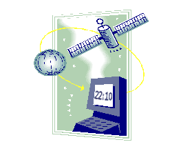
Timekeeping
- Bringing precise time to the world
Although GPS is well-known for navigation, tracking, and mapping, it's also used
to disseminate precise time, time intervals, and frequency. Time is a powerful
commodity, and exact time is more powerful still. Knowing that a group of timed
events is perfectly synchronized is often very important. GPS makes the job of
synchronizing our clocks easy and reliable.
There are three fundamental ways we use time. As a universal marker, time tells
us when things happened or when they will. As a way to synchronize people,
events, even other types of signals, time helps keep the world on schedule. And
as a way to tell how long things last, time provides and accurate, unambiguous
sense of duration.
GPS satellites carry highly accurate atomic clocks. And in order for the system
to work, our GPS receivers here on the ground synchronize themselves to these
clocks. That means that every GPS receiver is, in essence, an atomic accuracy
clock.
Astronomers, power companies, computer networks, communications systems, banks,
and radio and television stations can benefit from this precise timing. One
investment banking firm uses GPS to guarantee their transactions are recorded
simultaneously at all offices around the world. And a major Pacific Northwest
utility company makes sure their power is distributed at just the right time
along their thousands of miles of transmission lines.
Beagle Software offers the
Star Sync product which sets any Windows computer
to the GPS clock and can serve as a time source for computers on a network.
We hope you've enjoyed our brief discussion about the technology behind GPS.
Additional Sources: NIST, NOAA, US Department of Defense, Garmin, Inc.,
Trimble Navigation Ltd.
Back to top
For more information:
Advanced Features
of Star Sync software
Star Sync GPS Receivers:
Installation Information
Antenna Mounting Options
Frequently Asked Questions about GPS
GPS Glossary
Star Sync Main Page
Star Sync Site Index
| | |